Base Layers
let's begin
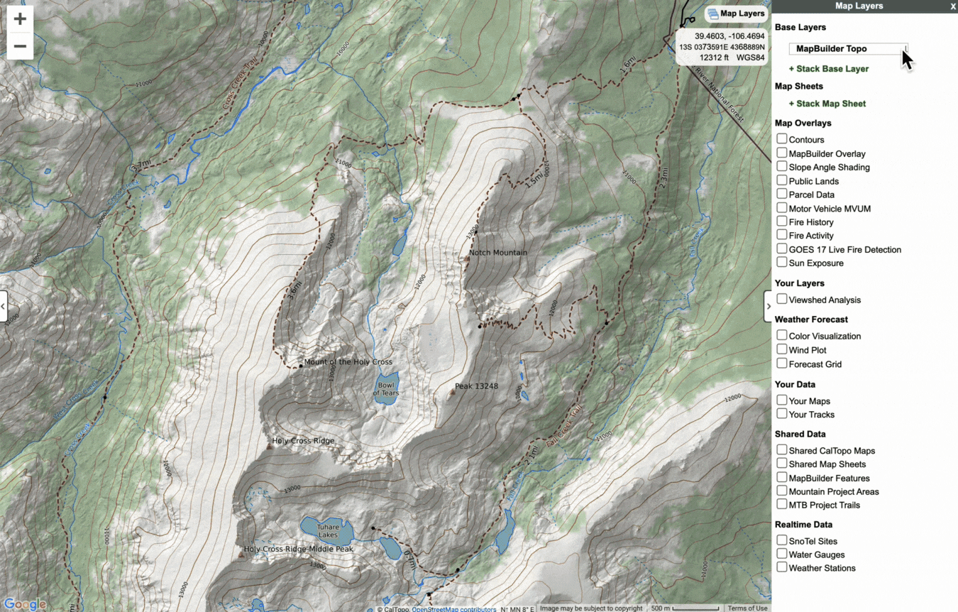
CalTopo has numerous tools and features that enable you to explore an area in depth and create highly personalized maps. Arguably one of CalTopo’s most powerful features is the wide range of base layers available that you can switch out and stack together in nearly any combination.
You can even create or import in your own custom base layers to meet your needs. The purpose of this chapter is to introduce you to base layers and teach you how to effectively utilize them to learn more about a particular area.
Lessons in this Chapter:
- Base Layer Descriptions
- Working with Base Layers
- Intro to Custom Layers
- Building Custom Layers within CalTopo
- Mapbox Layers with Your Data
- Custom Layers from External Sources
- Web Feature Service WFS
Topics on this Page:
Base Layer Basics
First let's take a look at what exactly a base layer is in CalTopo.
What is a Base Layer?
Base layers are digital maps or imagery that make up the background of CalTopo, and that you can draw and view map objects on. They are representations of a location on the surface of the earth. You use base layers to learn more about an area as you plan your trip or mission. You might want to know what trails there are, the locations of potential water sources, what the terrain is like or where the snow line currently is. What you want to learn about an area will determine which base layer(s) will be the most useful to you at that particular moment.
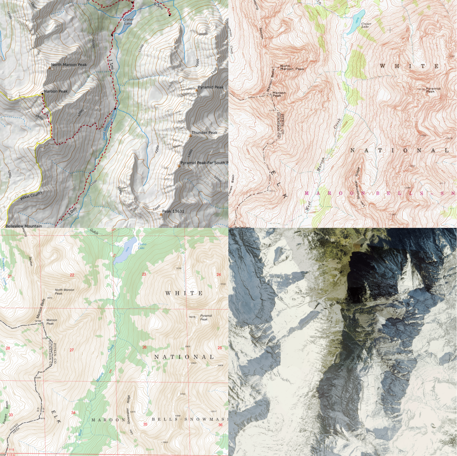
CalTopo provides a wide selection of base layers. Each base layer is carefully selected to complement and contrast the other base layers available. Some of these base layers may look very familiar to you- for example, many people have used or encountered paper map versions of the Scanned Topos (especially from the USGS) and Forest Service base layers.
Other base layers may look totally different from anything you’ve worked with previously- for example, MapBuilder Topo pulls data from a variety of sources including USGS data sets, OpenStreetMap (OSM) and high resolution LIDAR for elevation (where available). Unlike the scanned topos, this base layer also dynamically adjusts as you zoom in and out to present the most relevant data for each zoom level.
Base Layer Accuracy
Sometimes we hear from users that a map is wrong; for example, they may reach out with concerns about a trail that no longer exists, is drawn or labeled incorrectly or cuts through private property. At CalTopo, we do not go out into the field and make measurements in order to create the maps that you see in our software; rather we package and present the data to you so that you can create your own customized map.
Our base layers draw from a broad variety of data sources. Some of these maps, such as the Forest Service layers, are static representations of that data from a specific point in time and cannot be modified. Other maps, such as MapBuilder Topo, are dynamic, reflecting changes and additions to the data in either real time or at set intervals when we pull updates. MapBuilder trails, roads and other features are largely pulled from Open Street Map. To learn more about OSM icluding how to edit these map feature Making OSM Edits